
Sept. 27
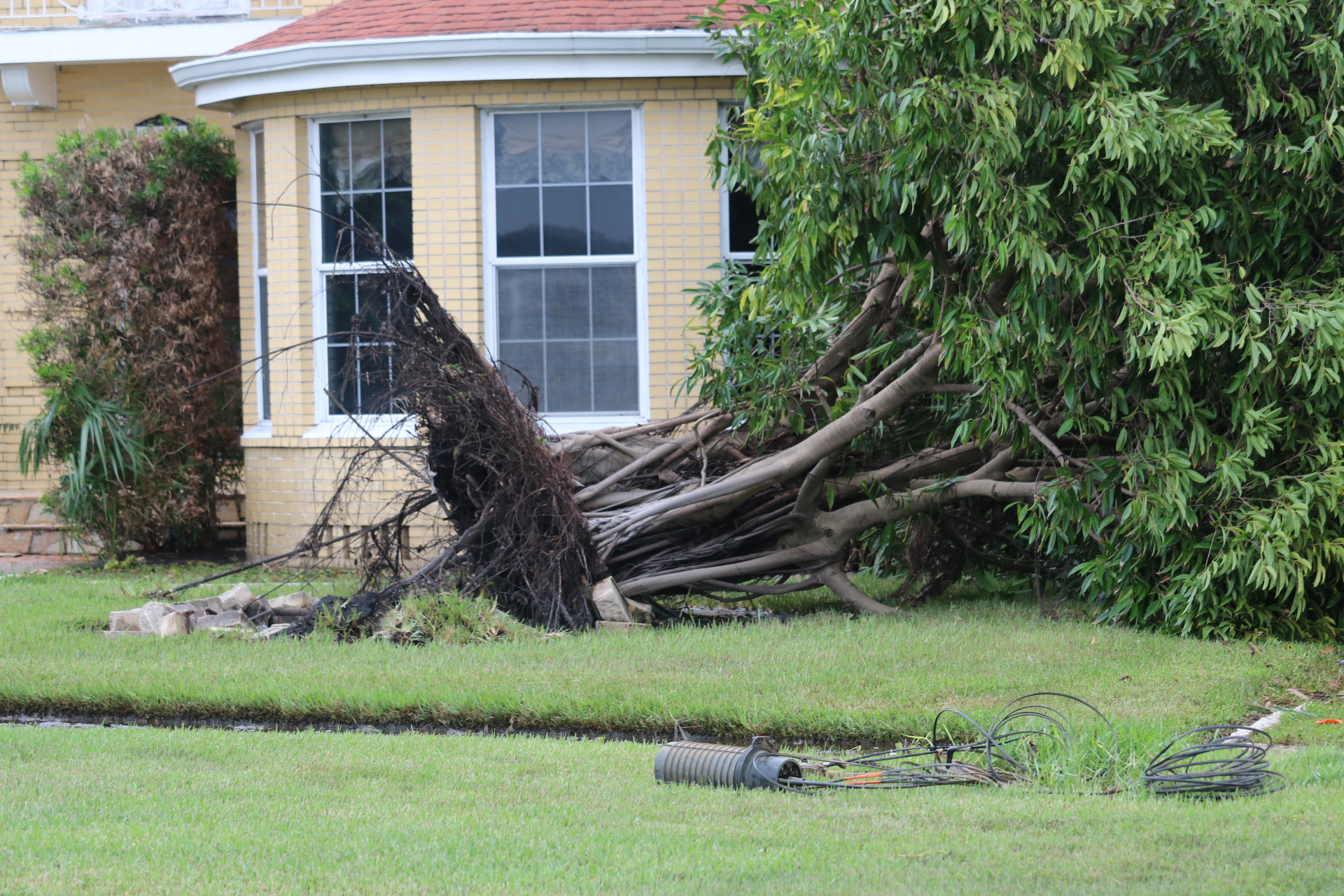
Hurricane Helene has left Fla. but the aftermath has left the city struggling.
Duke Energy of Florida said in a statement, at 7:30 a.m. there were about 8,000 crew members out restoring power.
They said there are over 402,000 still without power. There is a live outage map for residents to see what areas customers still don’t have power.
The university sent out an email at 9:30 a.m. that said campus is out of power, but did not sustain damages. The plan is to reopen Mon. but at this time they do not know when power will be restored.
Davis Island is still closed along with Bayshore due to the storm surge. Boat rescues have been in Davis Island since last night.
Parts of The Gandy Bridge is reopened, but The Howard Frankland Bridge, Skyway Bridge, and Courtney Campbell Causeway remain closed at this time.
Tampa General Hospital has reopened and is accepting patients.
UTampa sent out an email at 1 p.m. that said Hillsborough County has lifted the mandatory evacuation for Zone A.
For more updates refer back to this article.
Photos from BayShore Blvd. Sept. 27


Photos by Leah Burdick.
Sept. 26
Bayshore started over flowing early afternoon. Waves crashing over the wall has caused the street to already be covered, before the hurricane gets here.
At around 3 p.m. and started to intensify in the Tampa area. The Howard Franklin Bridge has closed due to the high winds and surf.
According to Tampa Duke Energy, there are more than 17,000 customers without power as of 4 p.m. today.
The forecasted storm surge is between five and eight ft. And up to 12 ft in Pasco County, according to The Tampa Bay Times.
Tampa is now under a tornado watch until 8 p.m. Many areas are under tornado watches and warnings down the coast.
Heavy rain started in the area around this time and The Courtney Campbell Causeway is closed due to storm surge and wind.
The Gandy Bridge has closed at 6:20 p.m. due to storm surge and strong wind.
Sept. 25
Mandatory evacuation for Hillsborough County Zone A. The evacuation started at 9 a.m.
Storm shelters have opened this morning at 9 a.m. They are located at Burnett Middle school, Middleton High School, Durant High School, Sickles High School, Reddick elementary, and Erwin Technical College.
UTampa students have to evacuate residential halls by 1 p.m. and will remain closed until the evacuation order is lifted.
The hurricane is 100 miles west-southwest of Cuba is predicted to be a category three storm when it hits landfall tomorrow.
Full campus operations will resume Mon. Sept. 30th.
Sept. 24
At 9:30 a.m. another UTAlert went out to students.
The email said that students will hear about operation changes by 4 p.m. today.
It also said to start having personal hurricane preparation plans made.
At this time the cyclone is currently 205 miles south-southeast of Cuba and news outlets are predicting it might be a category three when it hits Florida.
Universities in St.Petersburg have already started evacuating students.
Eckerd College has enacted their campus closure plan.
Hernando County schools announced they plan to close Wednesday and Thursday.
UTampa will be canceling classes for the rest of the week and will resume back on Monday.
There is high speculation that Hillsborough will have a mandatory evacuation.
Campus will be closed starting tomorrow. More information on students living on campus should be released soon.
4:35 p.m. the campus sent out an alert that Zone A evacuations can begin as early as tomorrow morning.
If evacuation order goes into effect, resident halls will close tomorrow at 1 p.m. They said they encourage students to start planing evacuation routes.
National Weather Service just sent out an Emergency Alert about a storm surge warning in effect. The warning is issued up to 36 hours before hazardous conditions begin.
Sept. 23
Gov. Ron DeSantis declared a state of emergency ahead of potential Tropical Cyclone Nine. The state of emergency will include Hillsborough County.
If the tropical storm turns into a hurricane it will be a category 2 hurricane called Helene. The National Hurricane Center (NHC) says the cyclone will reach hurricane strength Tuesday night. The NHC said the projected path will hit Florida Thursday night.
Sandbag distribution sites are open in most counties. BayNews9 has a list of sites that have opened today.

The NHC said to expect storm surge and heavy rain fall.
Evacuation zones can help when mandatory evacuations are initiated. At this time there are no mandatory evacuations. The University of Tampa is located in evacuation zone A.
If the storm strengthens into a hurricane and is on a path towards Tampa, there is a high chance campus will be the first evacuated.
On the 2024 Hurricane Evacuation Assesment Tool Map, it organizes each evacuation zone and storm shelter statuses.
For more information to better prepare ahead of this storm Hillsborough County website has multiple resources.
The University just sent out their first email at 4:20 p.m. about the cyclone.
They said there will be update posts on the Tropical Weather Page.
—
Last updated Sept. 27, 2024 at 1:20 p.m.